Recent Posts
ODSE Conference: Research & Applications
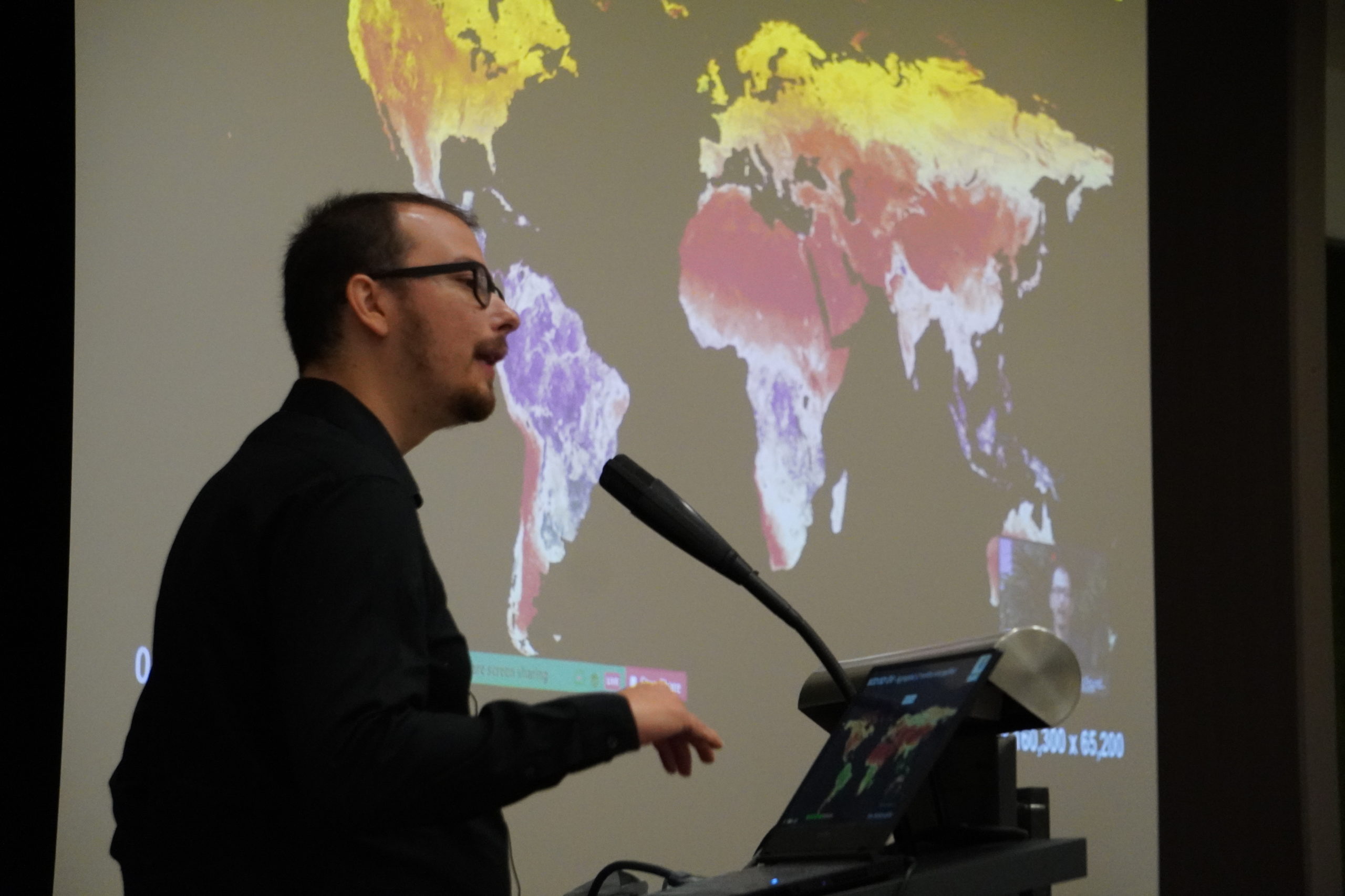
The ODSE conference offered the stage to a diverse range of researchers and project representatives from all over Europe, illustrating methodological advancements and applications of geospatial research and EO.
Harmonizing pan-European datasets – experiences from GISCO
by Hannes Reuter (EUROSTAT)
Hannes Reuter, Statistical Officer – EUROSTAT, outlined the ‘Geographical Information System of the COmmission’ (GISCO), a permanent service of Eurostat that fulfils the requirements of both Eurostat and the European Commission for geographic information and related services at European Union (EU), Member State and regional levels. These services are also provided to European citizens at large. GISCO’s goal is to promote and stimulate the use of geographic information within the European Statistical System and the European Commission.
Mapping biodiversity patterns for Environmental Impact Assessments (EIA) using remote sensing
By Pablo Pérez Chaves (FinnOC)
Pablo Pérez Chaves is the Director of Environmental Services at Finnish Overseas Consultants (FinnOC)
In his talk, Pablo outlined the Environmental Impact Assessments (EIA) process to assess project’s impacts on the environment, including biodiversity, a powerful tool to propose mitigation measures when tackling negative impacts. However, these assessments often underestimate the impacts on biodiversity due to lack of continuous biological information covering the whole targeted area.
Pablo’s work explored the potential of combining existing biological field-data with satellite images, such as Landsat Satellite images,as a cost-effective way to predict biodiversity patterns in areas far beyond the location of field-data, offering the possibility of reliable continuous biodiversity patterns for EIAs. This innovative biodiversity mapping method allows for properly quantifying a project footprint’s impact on biodiversity and identifying suitable areas for “like-for-like” compensation schemes
Creating Geo-Harmonized PM2.5 maps over Europe using machine learning
by Saleem Ibrahim (CTU)
Saleem Ibrahim, Researcher at the CTU in Prague, presented high resolution (1 km), full coverage of inhalable particulate matter (PM2.5) maps of whole Europe for the years 2018–2020 using open-source data. This was a major finding of his study, which aims at gaining a better understanding of these small particles, one of the most harmful air pollutants to all living things. The biggest challenge is the ground measurement tools, by highly-expensive ground stations limiting the coverage of estimations. To accelerate the process and reduce costs, the work of Saleem explored the application of machine learning and deep learning algorithms to estimate PM2.5 using multiple sources like satellite retrievals of Aerosol Optical Depth (AOD) and other auxiliary data, such as meteorological data, land cover, land use, among others.
Exploring Copernicus products and machine learning for health applications
by Rochelle Schneider (phi-Lab)
Rochelle Schneider is a Research Fellow in Artificial Intelligence for Earth Observation at European Space Agency (ESA), and she expounded the development of a multi-stage satellite-based machine learning (ML) model to estimate daily PM2.5 levels across Great Britain during 2008-2018. Stage-1 estimated PM2.5 concentrations in monitors with only PM10 records. Stage-2 imputed missing satellite aerosol-optical-depth due to cloudiness and bad retrievals. Stage-3 applied the Random Forest algorithm to estimate PM2.5 concentrations using a combined dataset from Stage-1, Stage-2, and a list of spatiotemporally synchronised predictors. Stage-4 estimated daily PM2.5 using Stage-3 model. The relatively high precision allowed these estimates (approximately 950 million points) to be used in epidemiological analyses to assess health risks associated with both short- and long-term exposure to PM2.5.
Spatio-temporal assessment of management impacts on peatlands - A case study of Ireland
by Wahaj Habib (Trinity College Dublin)
Wahaj Habib is a Postgraduate (PhD) Student at the Trinity College Dublin, and he illustrated the results of his study on peatlands monitoring in Ireland. Peatlands have been under severe pressure globally due to anthropogenic activities, ans in Ireland, approximately 90 % of the peatlands have been degraded to some extent due to these activities. Peatlands play also an important role to achieve temperature goals agreed in the Paris agreement and in fulfilling the EU’s commitment to quantifying the Carbon/Green House Gases (C/GHG) emissions from land use, land-use change forestry. Therefore, accurate mapping and identification of management related activities (land use) on peatlands has become a research and management priority.
Bringing the App to the data - State of Play for EO data exploitation
by Ingo Simonis (OGC)
Ingo Simonis is chief technology innovation officer at the Open Geospatial Consortium (OGC).
At the ODSE conference,he explained how platforms for the Exploitation of Earth Observation (EO) data have been developed by public and private companies in order to foster the usage of EO data and expand the market of Earth Observation-derived information. His talk described the general architecture, demonstrates the Best Practices, and includes recommendations for the application design patterns, package encoding, container and data interfaces for data stage-in and stage-out strategies. The session further outlined how to interact with a respective system using Jupyter Notebooks and OGC Web APIs.
GRASS GIS-8: from desktop to big data cubes
by Veronica Andreo
sits, an open-source R package for satellite image time series analysis using machine learning
by Gilberto Câmara (National Institute for Space Research Brasil)
Gilberto Câmara is part of the INPE, the National Institute for Space Research. In his talk, Gilberto described an open-source R package for satellite image time series analysis using machine learning. It supports the complete cycle of data analysis for land classification, while its API provides a simple but powerful set of functions. The software works in different cloud computing environments, including AWS, MS-Azure, and Digital Earth Africa. In sits, satellite image time series are input to machine learning classifiers, and the results are post-processed using spatial smoothing. Since machine learning methods need accurate training data, sits includes methods for quality assessment of training samples. The software also provides methods for validation and accuracy measurement. The package thus comprises a production environment for big EO data analysis. The package is available on https://github.com/e-sensing/sits and the documentation is available on https://e-sensing.github.io/sitsbook/.
Land cover time-series data stack for Europe 2000--2019 based on LUCAS, GLAD Landsat and Spatiotemporal Ensemble Machine Learning
by Martijn Witjes (OpenGeoHub)
Martijn Witjes is a PhD candidate at OpenGeoHub foundation. In this talk, he expounded the first results of his research on land cover time-series data stack for Europe between 2000 and 2019. The classification sees 33 different land use / land cover (LULC) classes between 2000 and 2019 using a single spatiotemporal ensemble machine learning model in a fully automated, free and open source workflow. This workflow includes harmonization and preprocessing of several high-resolution publically available covariate datasets and over five million training samples, spatial K-fold cross-validation, hyperparameter optimization, and multiple methods for LULC change analysis. Martijn also showed how the per-class probability predictions facilitated useful prediction uncertainty metrics, informed use case-tailored post-processing strategies, and enabled a novel way to quantify LULC change dynamics without relying on hard-class predictions. The results of his study suggest that the method developed by his team, enables land cover classification for subsequent years without waiting for new training data, while facilitating improved training data collection through analysing variable importance, per-class performance, and uncertainty metrics.
High resolution predictions of potential and actual distribution of forest tree species for Europe (2000-2020) based on spatiotemporal Machine Learning
by Carmelo Bonannella (OpenGeoHub)
Carmelo Bonnanella, PhD candidate & research assistant at OpenGeoHub, presented the results of modeling species distribution maps for both potential and actual natural vegetation through spatiotemporal machine learning using a data-driven, robust, objective and fully reproducible workflow. The presentation focussed on the benefits of using ensemble machine learning for species distribution modeling to capture patterns of niche changes in both space and time: yearly (from 2000 to 2020) probability distribution maps for both potential and actual natural vegetation were shown for forest tree species that live in different climatic conditions across Europe. The high spatial (30 m) and temporal (1 year) resolution of the outputs should allow us to enhance and better understand the patterns of niche change.
Detecting land degradation using time-series analysis of EO Vegetation products (MODIS EVI, Proba-V, Landsat)
By Leandro Parente (OpenGeoHub)
Leandro Parente is a postdoctoral researcher at OpenGeoHub, supporting the foundation’s current and future European Commission-funded and other international projects where there is a need to develop new solutions for geocomputing, optimize and automate modeling frameworks and deliver scientific outputs. In this talk, Leandro illustrated how to detect land degradation using time-series analysis of EO Vegetation products (MODIS EVI, Proba-V, Landsat).
Modeling and prediction of wind damage in forest ecosystems of the Sudety Mountains, SW Poland
by Łukasz Pawlik (University of Silesia)
Lukasz Pawlik is a PhD candidate at University of Silesia in Katowice at the Institute of Earth Sciences. His research focuses on the effects of windstorms on European forest ecosystems. In his presentation, Lukasz explained how the combination of several data sets on tree features, bioclimatic and geomorphic conditions, and the level of forest damage in the Sudety Mountains over the period 2004-2010, to map forest damage probability based on forest data from 202. Eventually, Lukasz focusses on how,using only 11 variables based on the open source datasets, his research effort was able to obtain predictive models of good accuracy.
Joint Research Centre, European Soil Data Centre - Mapping projects at the European Soil Data Centre
by Panos Panagos (JRC, European Commission)
Panos Panagos is part of the Joint Research Centre, European Soil Data Centre, and in this talk, he described the work of the European Soil Data Centre (ESDAC), which is producing several interesting new data sets based on predictive soil mapping
Visualizing two decades of land use changes in Europe
by Chris van Diemen (OpenGeoHub)
Chris van Diemen is a Geospatial researcher at OpenGeoHub Foundation. In this talk, Chris explained how current developments in computing power and a rocketing increase in the efficiency of geospatial computing has made it possible to analyse the archive of Landsat images that date back to the year 2000 at 30 meter resolution for the entire continent of Europe. Chris also discussed some specific examples of interpretations that these new approaches allow. Through different examples, his talk took the audience from the forest harvesting in Sweden to the hydroelectric dams in Portugal, over mysterious changes in the Alps to the apparent reforestation of the Romanian forests.
Pan-european seasonal cloudless mosaic based on Sentinel-2 imagery
Josip Križan (MultiOne)
Josip Križan is the owner of MultiOne. In this talk, Josip introduced how the rapidly increasing amount of publically available remotely sensed data in recent decades has revolutionized large-scale research and context-informed decision making. However, these data are generally not freely available as homogenized products ready for analysis at continental (or larger) scales. This is widely observed with datasets generated by EO satellites, particularly those with optical sensors and those capable of high-resolution imaging, where the process of mosaicking imagery to produce a homogenous, cloudless dataset across a particular area of interest often grows increasingly cumbersome at larger scales.
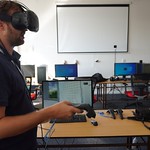
Land Cover viewer in AR/VR
by Karel Pavelka Jr. (CTU)
Karel Pavelka works at the Czech Technical University in Prague. In this presentation, Karel took the audience through an interactive journey with a recently developed 3D ODSE viewer.
AgriCaptureCO2 - Digital platform to support regenerative agriculture
by Dragutin Protic (GiLAB)
Dragutin Protic, Co-founder and CEO of Gilab doo,
Presented the EU-funded AgriCaptureCO2 project, which aims at developing a systematic, robust and flexible platform for quantifying SOC capture as well as verifying and promoting farmers’ application of regenerative agriculture (Reg Agri). The digital, web-based platform will provide four services, namely: Quantification, Exploration, Support and Verification, that will run on EO data. The idea is that the services provide information that will support the process of certification of “carbon credits” generated as the result of Reg Agri and verification of Reg Agri practices’ application as a prerequisite for any incentives for farms.
CERES project- Earth Observation-based information for “smarter” agriculture and carbon farming
by Branislav Bajat (University of Belgrade)
Branislav Bajat, Faculty Member of the University of Belgrade, illustrated the CERES project. In this talk, he explained how the use of AI in agriculture should be especially important in Serbia, as agriculture is one of the crucial sectors of Serbian economy. This project will be an important step forward in the application of a wide range of relevant data generated on a daily basis and offering a huge potential for improving agricultural production and developing the concept of smart and regenerative agriculture.
MAPSPAM-C: An R package to create crop distribution maps
by Michiel van Dijk (IIASA)
Michiel van Dijk is a senior researcher in the international policy department at Wageningen Economic Research, Wageningen University and Research. In this talk, Michiel explained the use of MAPSPAM-C, and R package that implements the SPAM procedure to create crop distribution maps and facilitates the pre-processing steps to harmonize spatial input layers and post-processing steps to create harvested area, physical area, yield and production maps. The package can be used to reproduce and validate the new generation of SPAM products and will be useful for researchers that want to create their own maps using country specific input data.
Spatio-temporal analysis of cropping intensification in western Morocco
by Abdelkrim Bouasria (Université Chouaïb Doukkali El Jadida)
Abdelkrim Bouasria is a PhD candidate at the Université Chouaïb Doukkali El Jadida, and in his talk he expounded the research work he conducted over cropping intensification. This strategy is operated for the profitability of equipment and hydro-agricultural facilities and contributes to the country’s food security.
Citizens Generating Reference Land Cover and Land Use Data with a Mobile App
Steffen Fritz (IIASA)
Steffen Fritz is Program Director at IIASA, Vienna. In this talk, Steffen discussed the role of citizen science to supplement and enhance massive field data collections, illustrating the example of the LUCAS survey data and the FotoQuest Go Europe 2018 campaign.
Spatial Information Infrastructures to Reduce the Global Maritime Transport Emissions
Benedikt Gräler (52north)
Spatiotemporal modeling of environmental dynamics at global scale: building open multiscale data cubes
By Tom Hengl, Leandro Parente (OpenGeoHub)
Leandro Parente is a postdoctoral researcher at OpenGeoHub, supporting the foundation’s current and future European Commission-funded and other international projects where there is a need to develop new solutions for geocomputing, optimize and automate modeling frameworks and deliver scientific outputs. In this talk, Leandro illustrated how to detect land degradation using time-series analysis of EO Vegetation products (MODIS EVI, Proba-V, Landsat).
Machine Learning for spatiotemporal data using mlr3
by Patrick Schratz ( cynkra)
Patrick Schratz is an R consultant at cynkra, Zurich, and in this talk he presented the mlr3 package for R. This package is geared towards scalability and larger datasets by supporting parallelization and out-of-memory data-backends like databases. While ‘mlr3’ focuses on the core computational operations, add-on packages provide additional functionality.
Open data and tools for global wildfire danger forecasting
by Claudia Vitolo (ECMWF)
Claudia Vitolo, Scientist at European Centre for Medium-Range Weather Forecasts (ECMWF), focussed her presentation on forest fire mapping.Data is open and available through the Copernicus Climate Data Store (CDS), the European Commission’s Global Wildfire Information System (GWIS) and European Forest Fire Information System (EFFIS).
Automated global land cover disturbance monitoring using BFAST Lite
Dainius Masiliūnas (Wageningen University & Research)
Dainius Masiliūnas is University Lecturer at Wageningen University & Research. Dainius spoked about automated global land cover disturbance monitoring using BFAST Lite.
-

CEF Telecom project 2018-EU-IA-0095.
This project, co-financed by the European Union,
is now officially closed. For any inquiry, please refer to the Open Earth Monitor website https://earthmonitor.org/- The GeoHarmonizer project consortium
- OpenGeoHub, Agro Business Park 10, 6708PW Wageningen, NL
- (+31) (0)317 427537 | | | | |
- coordination-team@earthmonitor.org
Previous events