5.a: Standardized 3D services, integrated into the metadata catalogue

Prepared by: Terrasigna and CTU in Prague
Executive summary
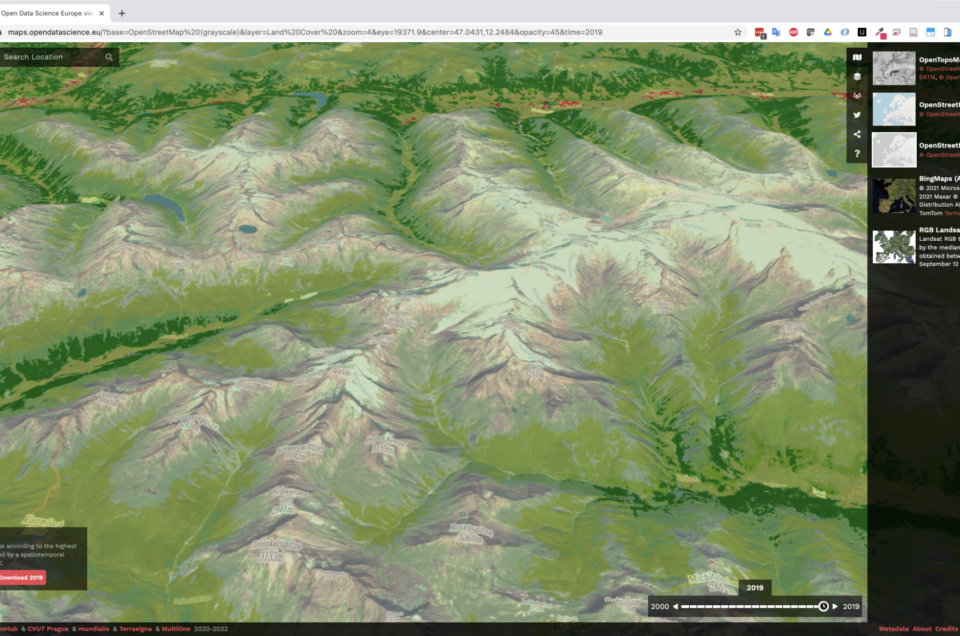
Geo-harmonizer geoportal (https://maps.opendatascience.eu) includes two 3D viewers created with the help of NASA WorldWind and Cesium libraries. Standardized 3D web services were deployed to provide the client applications with digital elevation model data. Technically this was achieved using GeoServer with the DDS/BIL Extension. The digital terrain data is exposed through OGC WMS in Binary Interleaved by Line (BIL) – image/bil format. The supplied GridCoverage2D undergoes appropriate subsampling, reprojection and bit-depth conversion. The output can be requested by the 3D viewers as 16bit Int or 32bit Float. The data is also available in Direct Draw Surface (DDS) – image/dds format. Three data sources were considered for the services:
- Geo-harmonizer DEM, European coverage, based on AW3D30, MERIT DEM, GLO-30 and EU-DEM;
- Copernicus DEM (GLO-30 Public), European coverage;
- NASA DEM, global coverage.
The service is accessible at https://geoserver.deap.terrasigna.io/geoserver/opendatascience/ows?service=wms&version=1.3.0&request=GetCapabilities. It was also integrated in the metadata catalogue.
![]()


