Output 3.b: Seamless continental Europe land cover time series at 30 m resolution

Prepared by: OpenGeoHub, CTU in Prague and Terrasigna
Executive summary
The layers that are currently available:
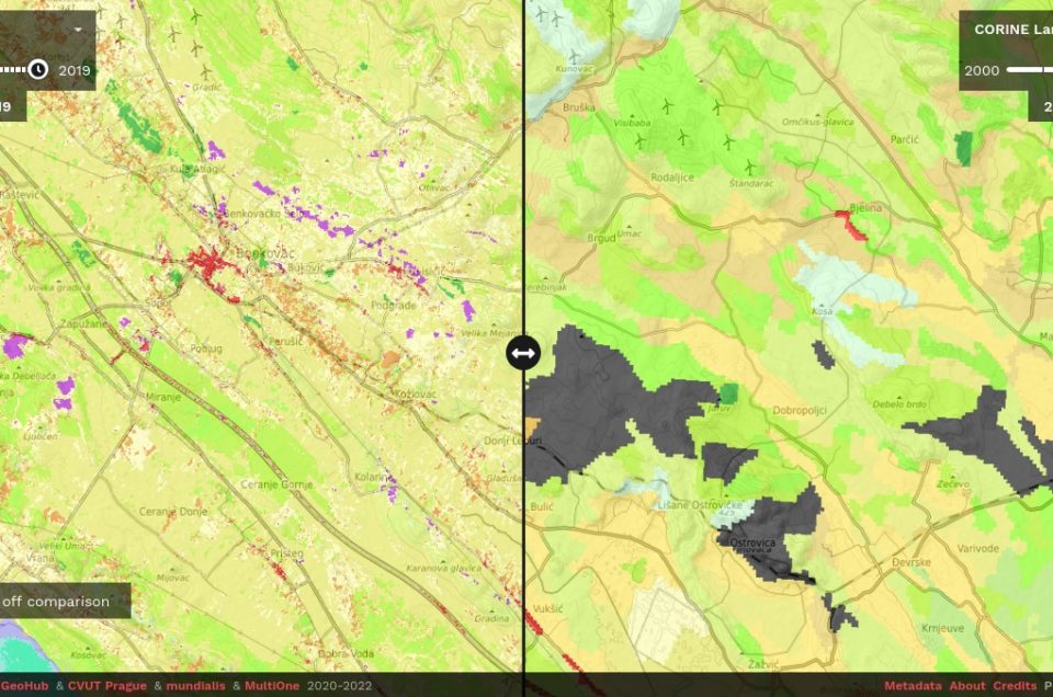
- Annual dominant land cover class based on CORINE (2000–2019);
- Annual probabilities and uncertainties for 33 CORINE land cover classes (2000–2019);
- Annual Landsat RGB composites for the summer season (June–September for 2000–2019);
- Annual Landsat NDVI composite derived by season (winter, spring, summer and fall – 2000–2020);
The annual land cover product for continental Europe was based on Ensemble Machine Learning (EML), which used training samples obtained from other European Commission funded projects, such as the LUCAS (Land Use and Coverage Area frame Survey) and the Copernicus Land Monitoring Service, and several harmonized raster layers (e.g. GLAD Landsat ARD imagery and Continental EU DTM) to predict the dominant land cover, probabilities and uncertainties for 33 classes compatible with CLC (CORINE Land Cover) over 20 years (2000–2019).
All layers are available publicly as Cloud-Optimized GeoTIFFs for download and for viewing from: https://maps.opendatascience.eu.
![]()


