5.b: 3D web visualization integrated into the Geo-harmoniser geo-portal
Prepared by: Terrasigna and mundialis
Executive summary
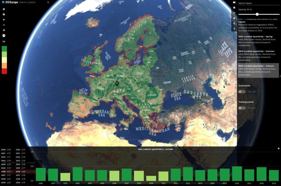
Geo-harmonizer geoportal (https://maps.opendatascience.eu) includes two 3D viewers created with the help of NASA WorldWind and Cesium libraries.
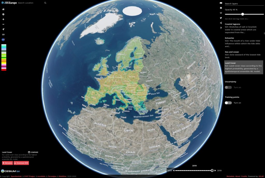
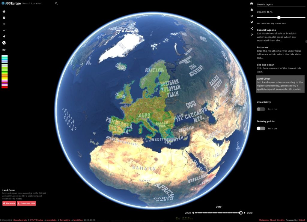
Web World-Wind library is a free and open-source virtual globe for HTML5 with a JavaScript API and a rich collection of features (eg: support for open formats such as GeoJSON, GeoTIFF, WKT, KML, Collada, Shapefile, OpenSearch for EO and open protocols like WMS, WMTS, WCS). Using the Web World-Wind library we developed a React component that helps users to explore and visualize the datasets made available by the Geo-harmonizer project. In the right side of the window, a sidebar with dedicated tabs is available for selecting different background maps, search for relevant data layers made available by the Geo-harmonizer project, Gitlab source repositories, Twitter messages related to Geo-harmonizer project, Share via social media options and a help for the available shortcut keys.
![]()