Recent Posts
As the project is closed, visitors should forward their requests to coordination-team@earthmonitor.org
(+31) (0)317 427537
Invited Speakers
- All Topics
- Agriculture
- AI
- Air quality
- Awards
- Big Data
- Climate data
- Conference
- Data Cubes
- Earth Observation
- Land cover
- Machine Learning
- Open source
- Policy
- Poster session
- Software
- Soil data
- Training sessions
- Vegetation mapping
- VR
Day 1
June 13, 2022Day 2
June 14, 2022Day 3
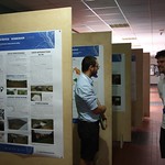
June 15Day 3 - Poster sessions
June 15 in the lobbyDay 4
June 16Day 4 - Poster Session
June 16 in the lobby
 9:00 - 10:30
Introduction to spatial and spatiotemporal data in Python
By Luka Antonić GIS Developer at MultiOne Ltd.Workshop room 1 - C221 Spatial referencing basics Reading/writing raster datasets Reading/writing vector datasets Accessing Geo-harmonizer datasets with eumap Space and spacetime overlay Working with dataset time-series Visualizing resultsBig DataSoftwareTraining sessions 9:00 - 10:30
Introduction to spatial and spatiotemporal data in R
By Tomislav Hengl Spatiotemporal Ensemble ML in R / computing with Cloud-Optimized GeoTIFFsWorkshop room 2 - C223 Introduction to RStudio, starting packages and loading data, Introduction to spatiotemporal datasets, eumap spatiotemporal datasets example: landcover 2000-2020 training dataset (Witjes et al, 2021), Visualizing spatiotemporal data and data summaries,Big DataSoftwareTraining sessions- 10:30 - 11:00
Coffee Break
Coffee break at the lobby; poster session and VR presentationsTraining sessions  11:00 - 12:30
Spatiotemporal machine learning in Python
By Martijn Witjes PhD candidate & research assistant at OpenGeoHubWorkshop room 1 - C221 Theoretical background for machine learning and python implementations Integrating raster data with scikit-learn models Why use pyeumap.LandMapper? Spatial overlay to prepare the training samples Spatial cross-validation to evaluate the ML model performance Hyperparameter optimization to tune the ML model Fitting the final ML model Generating spatial predictions using the fitted model Theoretical background for Ensemble ML and python implementations General concepts and main advantages of spatiotemporal machine learning Why use LandMapper? Spacetime overlay to prepare the training samples Spacetime cross-validation to evaluate the EML model performance Hyperparameter optimization to tune the EML model Fitting the final EML model Generating spatial predictions using the fitted modelMachine LearningSoftwareTraining sessions- 11:00 - 12:30
Spatiotemporal Ensemble ML in R
By Tomislav Hengl Spatiotemporal Ensemble ML in R / computing with Cloud-Optimized GeoTIFFsWorkshop room 2 - C223 Introduction to Ensemble Machine Learning: the mlr3 framework, Selecting learners, fine-tuning, feature selection and model stacking, Using Machine Learning with spatial and spatiotemporal data: Using ML for spatial interpolation: landmap package (vs geoR and similar geostatistical software), Adding geographical distances and features to spatial interpolation, Fitting and using EML for predicting eumap land cover data (Witjes et al, 2021),AIMachine LearningTraining sessions - 12:30 - 13:30
Lunch time!
Lunch Break at the National Library of Technology, café Prostoru (https://cafe.prostoru.cz)  13:30 - 15:00
High performance computing in Python
By Leandro Parente Spatiotemporal Ensemble ML / High Performance Computing in PythonWorkshop room 1 - C221 What are the possibilities to improve the performance of computation in Python? Performing Numpy operations using multicore processing Accelerate python functions using Numba Fast numerical expression using NumExpr Using the TilingProcessing to distribute raster operations in multiple coresBig DataSoftwareTraining sessions 13:30 - 15:00
Forest species distribution modelling and spatial planning in R
By Carmelo Bonnanella PhD candidate & research assistant at OpenGeoHubWorkshop room 2 - C223 Introduction to species distribution modeling (SDM), Common sources of species occurrences, Dealing with absence data and pseudo-absence generation, Dealing with spatial clustering and preferential sampling, Which predictors? How many? Fitting and interpreting species distribution models using R and ensemble ML, Producing predictions of realized distribution, Investigating variable importance and model uncertaintyMachine LearningSoftwareVegetation mapping- 15:00 - 15:30
Coffee Break
Coffee break at the lobby; poster session and VR presentationsTraining sessions  15:30 - 17:00
Introduction to ODSE datasets in Python/QGIS
By Tomáš Bouček Czech Technical University in Prague | ČVUT · Department of Geomatics, Leandro Parente Spatiotemporal Ensemble ML / High Performance Computing in PythonWorkshop room 1 - C221 Introduction to JupyterLab and python libraries Introduction to spatiotemporal datasets, Theoretical background for spatial and spatiotemporal machine learning, Eumap library (gapfilling and mapper modules) Eumap spatiotemporal datasets example: landcover 2000-2020 training dataset (Witjes et al, 2021),Big DataData CubesEarth ObservationLand coverMachine LearningSoftwareTraining sessions- 15:30 - 17:00
Time-series analysis using the European Environmental Data Cube
By Tomislav Hengl Spatiotemporal Ensemble ML in R / computing with Cloud-Optimized GeoTIFFsWorkshop room 2 - C223 Accessing COG files using QGIS, Using gdaltiler to produce plots in Google Earth (local copy), Finding trend lines using stacks of rasters,Big DataData CubesTraining sessions
- 9:00 - 10:30
Using SpatioTemporal Asset Catalog (STAC) in Python
By Leandro Parente Spatiotemporal Ensemble ML / High Performance Computing in PythonWorkshop room 1 - C221 Why STAC and Cloud-Optimized GeoTIFF (COG)? Generating COG files using GDAL Providing COG files through S3 protocol Accessing remote COG files in Python Publishing COG in STAC Accessing COG through STACBig DataEarth ObservationTraining sessions  9:00 - 10:30
GRASS GIS 8 (Part 1): Introduction and new features
By Markus Neteler Cofounder and senior consultant at mundialis, Martin Landa CTU in PragueWorkshop room 2 - C223 Introduction to the new version 8 of GRASS GIS, a few concepts Showcase the heavily redesigned graphical user interface Interaction with data (visualization, styling, map elements) Analysis of data from different domains Introduction to automated processing Hints on Python 3 scripting, spatio-temporal data analysis, and more. Candidate datasets: improved ERA5 land air temperature, surface temperature and precipitation (daily data) The software requirements are: GRASS GIS 8AIMachine LearningSoftware- 10:30 - 11:00
Coffee Break
Coffee break at the lobby; poster session and VR presentations - 11:00 - 12:30
Geospatial deep learning in Python
By Ondřej Pešek Czech Technical University in Prague (ČVUT) · Department of Geomatics, Luka Antonić GIS Developer at MultiOne Ltd., Martijn Witjes PhD candidate & research assistant at OpenGeoHubWorkshop room 1 - C221 Brief explanation of the general concept of deep learning and CNNs Writing a simple CNN from scratch and testing it on an easy geo-classification task Using a predefined CNN architecture to perform land cover classification in Prague Introduction to a deep learning quest that continues throughout the rest of the workshop week (optional)AIMachine LearningSoftware - 11:00 - 12:30
GRASS GIS 8 (Part 2): Processing multitemporal EO data
By Markus Neteler Cofounder and senior consultant at mundialis, Martin Landa CTU in PragueWorkshop room 2 - C223 GRASS GIS supports time series processing for vector, raster, and volume data Micro-introduction to Landsat and Sentinel satellite data archives, and the various ways to access them Introduction to the i.sentinel toolset which allows querying Sentinel data coverage for a region of interest, downloading from multiple data sources, performing atmospheric and topographic corrections, and cloud/shadow masking Preparation of data for multitemporal analyses is enabled in the t.sentinel and t.rast.mosaic extensions through automatic creation of space-time raster datasets (strds) and temporal aggregation to obtain cloud-free temporal mosaics of arbitrary granularity. Computation of NDVI time series Candidate datasets: Use Sentinel, ERA5 land air temperature, surface temperature and precipitation (daily data)AIBig DataEarth ObservationMachine LearningSoftware - 12:30 - 13:30
Lunch Time!
Lunch Break at the National Library of Technology, café Prostoru (https://cafe.prostoru.cz) - 13:30 - 15:00
Working with Geo-harmonizer processing services
By Ondřej Pešek Czech Technical University in Prague (ČVUT) · Department of Geomatics, Markus Neteler Cofounder and senior consultant at mundialis, Martin Landa CTU in PragueWorkshop room 1 - C221 Introduction into web processing (OGC WPS, OGC API - Processes, REST API) in a comparative view Accessing WPS processes Accessing WPS processes from Python code using OWSLib Accessing WPS processes from QGIS actinia cloud computing with REST API (@neteler @metzm) explain how REST and actinia work actinia in Jupyter notebook actinia-QGIS pluginClimate dataData CubesLand coverSoftwareSoil dataTraining sessionsVegetation mapping  13:30 - 15:00
Introduction to Web Mapping Services
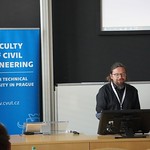
By Milan Kilibarda University of Belgrade,Faculty of Civil Engineering, SerbiaWorkshop room 2 - C223 Typical architecture of web map applications Introduction to OGC services (WMS, WFS, WCS) Web mapping servers and clients Accessing the ODSE services Web mapping application demonstrationTraining sessions- 15:00 - 15:30
Coffee break
Coffee break at the lobby; poster session and VR presentations - 15:30 - 17:00
Working with harmonized LUCAS dataset
By Tomáš Bouček Czech Technical University in Prague | ČVUT · Department of Geomatics, Lukáš Brodský Charles University, Faculty of Science Department of Applied Geoinformatics and Cartography, Martin Landa CTU in PragueWorkshop room 1 - C221 Introduction to LUCAS dataset provided by Eurostat Harmonized LUCAS dataset Accessing LUCAS dataset using Python API (Jupyter notebooks) Land product validation with LUCAS points (use case) Accessing LUCAS dataset from QGISBig DataEarth ObservationTraining sessions  15:30 - 17:00
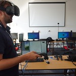
Geo-harmonizer AR/VR applications
By Eva Matoušková Czech Technical University in Prague, Faculty of Civil Engineering, Karel Pavelka Jr.Workshop room 3 - B869 Interactive session how augmented and virtual reality can be used for GIS data visualisation and how these technologies can be used in the future. This session will be situated in a special VR room with up to 6 VR stations. Visitors can explore the virtual world inside of the beta Geo-Harmonizer VR application and experience how it is possible to process and visualise Land Cover data sets thanks to this technology. Visitors can also test our augmented reality application on iPad. Opportunity to try VR and AR Geo-harmonizer application with land cover data setsAITraining sessions
- Welcome session - Welcome to participants, Introduction of the GeoHarmonizer project, its scopes, goals and outcomes, Introduction of all partners involved.ConferenceWhereConference room - C202
 9:25 - 10:05
The Open Source Geospatial Foundation - our international community
By Codrina Ilie Remote sensing/GIS specialist at TerrasignaOpen source solutions for geospatial are no news for most of us. Whether we are users or developers, there is a very high probability that we’ve been exposed to one or more software solutions to answer our various geospatial data processing and visualisation needs. Furthermore, the lucky ones among us have also participated at dedicated workshops, code sprints, or conferences international or regional such as the Free and Open Source for Geospatial - FOSS4G. However, some of you might not know that all these activities form a bigger, international and encompassing community - the Open Source Geospatial Foundation. Through this talk, we aim at offering an introduction to what OSGeo is, how it works and what it does.Big DataConferencePolicyWhereConference room - C202- 10:10 - 10:30
actinia: geoprocessing of GIS and EO data in the cloud
By Markus Neteler Cofounder and senior consultant at mundialisWith the rapidly growing availability of Earth observation and geospatial data, the need for scalable geoprocessing solutions is also increasing. Following the paradigm of bringing the algorithms to the data, we have developed the cloud-based geoprocessing platform actinia (https://actinia.mundialis.de and https://github.com/mundialis/actinia_core). This free and open source solution is designed as microservices and can ingest and analyze large amounts of data in a parallelized manner. actinia provides an HTTP REST API around GRASS GIS functionality, extended by ESA SNAP and user scripts and libraries written in Python, C or C++. Core functionality includes processing of raster and vector data and time series of satellite imagery (Landsat, Sentinel-1, Sentinel-2, Pleiades, etc.). actinia is an OSGeo community project since 2019 and a backend of [openEO] (https://openeo.org). Recently added process chain templating, STAC support, a Python client, a QGIS plugin, Jupyter notebooks, and more. This presentation gives an overview about the actinia and its latest developments.Big DataConferenceData CubesOpen sourceSoftwareWhereConference room - C202 - 10:30 - 11:00
Coffee break
Coffee break at the lobby; poster session and VR presentations  11:00 - 11:40
Spatio-temporal modeling of changing topographies: from point clouds to tangible interfaces
By Helena Mitasova Associate Director at the Cennter for Geospatial Analytics, North Carolina State University (US)Emergence of lidar technologies has redefined how we monitor, analyze and visualize earth surface. Elevation data now cover bare earth along with structures and vegetation over multiple time snapshots capturing dynamics of landscape processes, 3D evolution of vegetation as well as urban development at sub-meter resolutions. In this presentation we explore GRASS GIS methods and tools for processing and visualization of mutlitemporal elevation data using several case studies. Urban topography is cost effectively updated by fusing UAS survey data with existing lidar-based elevation models. Seamless elevation coverage is created from fragmented lidar and UAS data to capture dynamic coastal topography. Structure and changes in vegetation and crop canopy are analyzed from lidar point cloud data and canopy surface models generated from UAS imagery. Impact of changes in topography and land cover are collaboratively studied using malleable physical models coupled with GRASS GIS in Tangible Landscape.Big DataConferenceData CubesLand coverWhereConference room - C202 11:45 - 12:25
Deep Learning Methods for Land Cover Mapping Change Detection
By John Wenzhong Shi Director, Otto Poon Charitable Foundation Smart Cities Research Institute, The Hong Kong Polytechnic UniversityThis is a keynote offered by prof John Wenzhong Shi from The Hong Kong Polytechnic University regarding Deep Learning Methods for Land Cover Mapping Change Detection.AIConferenceLand coverMachine LearningWhereConference room - C202- 12:30 - 13:30
Lunch Break!
 13:30 - 13:50
Utilising Sentinel-2 timeseries data at the field parcel scale to identify the temporal risk of soil erosion in European agricultural landscapes
Combining Sentinel-2 Earth Observation data with integrated administration and control system (IACS) field parcel boundary data from EU member states allows new object-orientated approaches to associate field parcels with their dynamical properties (e.g. cropping and management practices, rainfall and soil moisture regime). This approach can better spatially target soil health related issues specific to field-parcels in agricultural landscapes in Europe, while incorporating the temporal dynamics of cropping systems when considering risks to soil with a time-dependent component. Soil erosion, a principle threat facing European soils, is typically time-concentrated into periods of low or absent crop canopy cover corresponding with erosive rainstorms. Given that these periods of risk vary with the climatic regime and cropping system employed, scalable methods built on large geospatial datasets can reveal key information on the soil erosion risk associated with field parcels across the European continent. Here, we present a user case combining gap-filled crop canopy cover dynamics from Sentinel-2 with quantifications of rainfall erosive potential (rainfall erosivity) from the REDES database to identify the time periods of elevated erosion risk associated with cultivated crops. We utilise a harmonised form of the available IACS data repository from 10 IACS data regions/member states as a spatial backbone to associate risk indicesAgricultureData CubesEarth ObservationPoster sessionSoil dataWhereConference room - C202- 13:50 - 14:10
Building a soil data cube at 30-m resolution for Continental Europe (2000–2022+) using spatiotemporal Machine Learning
By Tomislav Hengl Spatiotemporal Ensemble ML in R / computing with Cloud-Optimized GeoTIFFsAlthough number of pan-EU predictions of soil properties already exist (Toth et al, 2017; Ballabio et al., 2019) these are based on still relatively coarse resolutions (250-m) and ignore the time-component of soil variation and which is highly relevant for many chemical soil properties. For example, soil pH (Huang et al., 2022) and soil organic carbon (Knotters et al., 2022) have changed significantly in the last 20–30 years; mainly due to land use intensification and conversion of natural wetlands and similar. In addition, predictions produced using only LUCAS are top-soil focused (0–20 cm) even incompatible with international standards such as 0–30 cm used by UNCCD / IPCC. We have hence built methodology for mapping and monitoring soil nutrients using cutting-edge machine learning methods and state-of-the-art publicly available Earth Observation data (GLAD Landsat; Sentinel-2). Our initial models for predicting soil variables fitted using spatiotemporal overlays and results of cross-validation show that these models are significant. Several originally prepared 30-m resolution covariates (landsat products especially Red, NIR and SWIR bands, NDVI, SAVI) seem to correlate significantly with dynamic soil pH, carbon content and hence can be used to provide predictions at unprecedented levels of detail. The soil component of the Open Data Science Cube is referred to as ODSE-SOIL.ConferenceData CubesEarth ObservationMachine LearningSoil dataWhereConference room - C202  14:10 - 14:30
Using Sentinel 2 data for spatiotemporal mosaic of bare soils creation and mapping soil properties using machine learning
By Daniel Žížala Research Institute for Soil and Water ConservationThe available satellite multispectral data from the European Copernicus programme allow, among other things, their use for the purpose of mapping soil properties. This can be done on images that capture the bare soil surface. Due to the fact that only a part of the land is free of vegetation cover at any one time, mapping can only be carried out over a limited area. For regional mapping, a spatio-temporal composite of satellite imagery is required from the time series of image data. Such a composite was created for the Czech Republic using Sentinel-2 data and Google Earth Engine. The bare soil composite was then used to predict soil properties (texture, carbon content, pH) using soil samples and machine learning methods. Specifically, the quantile random forest method was used to both predict the target variables and to determine prediction intervals at single image points. This resulted in a unique set of high spatial resolution maps of soil properties of Czech soils.Big DataConferenceEarth ObservationMachine LearningSoil dataWhereConference room - C202- The landscape is everywhere around us. It is a place to live for people and animals. Over the times, it is affected by many factors that change and evolve. Changes of the landscape are monitored using Copernicus satellite data, ground sensors and monitoring facilities in the sea and in the air. The presentation will focus on usage of Copernicus data services for land monitoring, the products of Corine Land Cover (since 1990), High Resolution Layers (since 2012) and Urban Atlas (since 2006). To show the changes in the Czech Republic specific areas were selected: Šumava mountains, mining areas in North-West Bohemia or Prague and its surroundings.ConferenceEarth ObservationLand coverMachine LearningWhereConference room - C202
- 14:55 - 15:25
Coffee Break
Coffee break at the lobby; poster session and VR presentationsWhereLobby  15:30 - 15:50
Developing solutions for automatic processing of Sentinel-1 imagery for monitoring applications
Presentation provides on overview of solutions developed for automatic Sentinel-1 multi-temporal imagery processing within the Earth Observation Automated Monitoring Open Platform project realized in the ESA InCubed programme. Two of the solutions are based on radar signal intensity (amplitude) change detection algorithms, focusing on a detection of open-water flooding in non-urban environments and on a detection of new building construction. The third solution utilizes interferometric technique for an estimation of linear and non-linear vertical displacements over technical infrastructure.Big DataConferenceData CubesEarth ObservationMachine LearningSoftwareWhereConference room - C202- Stability monitoring is based on the evaluation and interpretation of the results of the displacement detection analysis. The automatic displacement detection analysis serves to monitor linear displacements of surface constructions using Synthetic Aperture Radar (SAR) images from Sentinel-1 mission. These displacements can be triggered by various processes (ground subsidence, underground mining, engineering works etc.). Long temporal series of satellite SAR images are analysed by custom implementation of Persistent Scatterers (PS) Interferometric SAR (InSAR) technique based on existing open source software (OST, SNAP). The whole Stability Monitor solution uses many open source components (Kubernetes, Docker, PostgreSQL/PostGIS, QGIS, GDAL etc.) and was developed within the ESA PropTech Kick-Start activity in 2021.ConferenceEarth ObservationLand coverWhereConference room - C202
 16:10 - 16:30
Open Geospatial System for LUCAS In-situ Data Harmonization and Distribution
By Martin Landa CTU in PragueLUCAS (Land Use and Coverage Area frame Survey) is an activity that performs repeated in-situ surveys over Europe every three years since 2006. The dataset is unique in many aspects, however, it is currently not available through a standardized interface, machine-to-machine. Moreover, the evolution of the surveys limits the change analysis with the dataset. Our goal was to develop an open-source system to fill these gaps.Big DataConferenceData CubesLand coverMachine LearningWhereConference room - C202- I will present new AddOns to get Climate data and Satellite imagery into GRASS and how added data can be further processed in GRASS GIS. The talk will cover processing Sentinel-2 data from the Norwegian Ground segment without downloading, as well as handling of Sentinel-3 data or data from JAXA platform (e.g. GCOM-C). THe respectie addons should be published before June 2022.Big DataClimate dataConferenceLand coverSoftwareWhereConference room - C202

 10:30 - 10:50
AquaLab - Geographic Information and Notification System for Water Reservoirs
The goal of the presentation is to present the project AquaLab that won the Environment, Energy and Health Challenge by DLR at the Copernicus Masters competition in 2020. The team of AquaLab consists of friends with similar education in geodetic engineering. The idea behind the project occurred at the beginning of 2020 when more than 100 000 inhabitants in Bulgaria were left without running water for more than 6 months. The water reservoir Student started drying out in June 2019. The decreasing levels were noticed in November 2019. AquaLab is a smart remote managerial system (GIS) for water reservoirs. It is based on Earth Observation Data (EO) and in-situ measurements. We use satellite data from the Copernicus Programme, mainly radar and optical data from Sentinel-1 and Sentinel-2. We have established a work frame on how to compute the water surface level and correlate the results with volumetric open data provided by the government. The web-based platform is intended to be free and available to all users interested in the topic. We want such data to be open to the society and raise the necessity of open EO and GIS dataBig DataConferenceEarth ObservationMachine LearningOpen sourcePoster sessionWhereLobby - Poster session 10:50 - 11:00
Estimation of Saturated Hydraulic Conductivity Using Pedotransferic Function for Selected Catchments within the Czech Republic
Hydrological models offer an effective way to obtain design parameters for landscape measures. However, lack of readily available data is one of the problems for hydrological modelling. Soil hydraulic properties are a key for hydrological modelling. Saturated hydraulic conductivity was estimated using a pedotransferic function. Basic soil data such as grain size, organic carbon content, and bulk density were used for estimation. The result is a map of saturated hydraulic conductivities covering selected catchments within the Czech Republic. This contribution has been supported by The Technology Agency of the Czech Republic Project TJ02000234 and The Ministry of Agriculture of the Czech Republic Project QK1910029Land coverPoster sessionSoil dataWhereLobby - Poster session- Virtual reality (VR) has seen rapid growth over the past decade. It has become particularly popular in the gaming industry for its ability to create an immersive simulation of presence in an artificial environment. However, its capabilities can also be used for scientific purposes, for example, to display real geographic data in a high level of detail. As part of a project by the Ministry of Culture of the Czech Republic, data collection of the vanished landscape around the Vltava River, a major Czech river, was carried out. This data was subsequently used as a basis for a realistic 3D model of the landscape with the addition of detailed parts (land cover, buildings, vegetation, water) using procedural modeling. Thanks to VR technology, it is possible not only to view this model on a flat screen but also to immerse oneself in it and let the landscape appear as if it were around us.Poster sessionVRWhereLobby - Poster session
- The high time required for hand rill identification is an obstacle in erosion research. Nevertheless, a significant number of grooves have already been manually marked for various studies. It is therefore possible to use these already obtained data to train an algorithm, which will then automatically identify the grooves. Before the simulation, during the pause between the simulations and after the experiment, the surface is scanned to create a 3D model. Keras is a deep learning API written in Python, running on top of the machine learning platform TensorFlow. The image is converted to a matrix, subsequently, this matrix is sequentially traversed in steps corresponding to the individual squares. The corresponding square is selected from each band and a mosaic is then created from these squares. The Kaggle Cat Dog model was used as the basis for creating the model. This model was modified by inserting mosaics into the model instead of images. The training dataset is loaded into the model and divided into calibration and validation parts for the purpose of model calibration. Loading mosaics for classification is controlled by a CSV file. The probability value with which the mosaic is classified as erosive or not is then added to this CSV file. The CSV file of the classified image is loaded back into the GIS environment using a Python script. The script loads the CSV file, and creates an according classified raster.Land coverMachine LearningPoster sessionWhereLobby - Poster session
 11:50 - 12:10
Integrating Earth Observation Into Area Frame Sampling Approach For Improved Crop Production Estimates.
Food security is a global concern, with around 690 million people suffering from food insecurity worldwide. The growing global population puts a strain on food demand and affecting the crop production. Food security is at the heart of the United Nation’s Sustainable Development Goals (SDGs) due to its global importance. Agricultural statistics are essential for achieving these goals. Agricultural census contains accurate information about crop production but it is costly. Earth observation can be useful resource to improve the crop production estimations. Long- term NDVI climatology of earth observation can capture the general agro-climatic conditions. SPOT- ProbaV NDVI series (1999-2020) was used to identify crop production system zones through ISO-DATA unsupervised classification. Then the relationship between these zones and administrative boundaries were assessed through stepwise multiple linear regression. Significant field-specific parameters, crop production system zones and administrative boundaries were merged together to quantify their combined impact on crop yield variability. Samples collection is very critical step for reliable and accurate crop production estimates. Earth observation explained only 23 percent yield variability whereas administrative boundaries based area frame sampling approach explained 39 percent.AgricultureAIEarth ObservationLand coverPoster sessionWhereLobby - Poster session- When calculating the leaf area index, it plays a role whether the raster data is taken against the ground or the sky, scale or location. In the paper, it is shown how the leaf area index is calculated from hemispherical photos and from Sentinel 2 and Landsat 8. For the entire workflow open-source software were used. Thanks to the characteristics of satellite data and the fact that one place is taken regularly, analyses of changes in the leaf area index can be monitored.Poster sessionVegetation mappingWhereLobby - Poster session
- With the advance in the field of machine learning, new possibilities open in many scientific disciplines, historic cartography included. Processes that used to take up to several years of manual labor to complete (i.e. map element classification) are now, thanks to advanced algorithmization, substantially simplified.AIEarth ObservationPoster sessionWhereLobby - Poster session
- 12:50 - 13:10
Random forest classification based on selected CORINE land cover classes and Sentinel-2 data
By Lucie StaráThis study investigates image classification based on open data and the usage of open source tools. The classification was performed on Sentinel-2 data with the use of the CORINE database. Three CORINE land use classes (permanently irrigated arable land, pastures, and natural grassland) report similar spectral responses which make it challenging to separate. Therefore, a multitemporal and multispectral approach was adopted using Sentinel-2 satellite imagery in combination with the NDVI vegetation index, Haralick’s textural measures, and topographic information. The workflow identifies a methodology for combining various groups of input data (optical, NDVI, textural, topographic) and explores the suitable use of the Random Forest classifier for the task. Initial image processing was performed in QGIS software, the classification was implemented in the Spyder environment. The classification was carried out in three different European locations. The results present a strong separation of arable land (F1 score over 96%) from the other two classes. Pastures and natural grassland classes achieved F1 in the range of 76% to almost 85% in both cases. In conclusion, we discuss the suitability of the CORINE database for such classification problems.Big DataLand coverMachine LearningPoster sessionVegetation mappingWhereLobby - Poster session  13:10 - 13:30
Extraction and Simulation of propagation of oil slicks on the sea surface: Case study of the Moroccan Exclusive Economic Zone
Due to its strategical geographic situation, Morocco is experiencing a heavy ship traffic. The ships accidents and illegal discharges, commonly called oil spills, are very frequent and present a big harm toward the marine ecosystem. These oil spills are affected by many natural phenomena, which facilitate and accelerate its spreading, making the forecast of the damages extent not very accurate. Therefore, the use of new technologies like satellites is crucial and will significantly help to monitor and assess these oil spills. The present work is based on Sentinel-1 SAR images and aim to take into evidence the extent of the hydrocarbons marine pollution, in a national framing (Moroccan Exclusive Economic Zone). More than 7000 images were examined and up to 100 possible cases were detected and mapped from January 2017 to December 2020. A batch process based on the detection of areas of reduced Normalized Radar Cross Section values, and considering corrections, masks, wind field estimation and oil clustering, was implemented to automatize the process. Almost 80% of the cases were detected between Kenitra and Casablanca. The mean distance of detected oil spills from coasts is about 35 km, while the Atlantic Exclusive Economic Zone boundaries are 370 km away from coasts (exempting the area near Canary Islands).Earth ObservationPoster sessionWhereLobby - Poster session- 13:30 - 13:50
Urban Green Areas Classification Using Convolutional Neural Networks
By Ondřej Pešek Czech Technical University in Prague (ČVUT) · Department of GeomaticsIf we simplify the picture of the world to an absolute minimum, we can say that there are only two remote sensing classes - urban areas and nature. A big part of the nature section is vegetation. Therefore, it is not a surprise that the vegetation detection, as well as the urban areas detection, constitutes a big part of remote sensing tasks, and very often these classes appear in remote sensing scenes together, side by side or within each other, separately or affecting one another. Such an effect can be seen in urban vegetated areas that could be either of natural or artificial origin and could serve different land use purposes. This talk focuses on seeing urban vegetation as one of two classes - for recreational purposes (such as public parks) and for other purposes (such as alleys or grass next to a road) - and explores whether we are able to determine such class from Sentinel-2 data using convolutional neural networks.Earth ObservationLand coverPoster sessionVegetation mappingWhereLobby - Poster session - A modern visualisation of a part of a former underground mine in Dolní Rožínka, today The Bukov Underground Research Facility (URF). The data used for creating the model of URF was collected using two non-metric photogrammetric cameras and was processed using the IBMR method. Component to the article was the creation of a virtual environment using the software Unreal Engine 4 (UE4)Poster sessionVRWhereLobby - Poster session


 9:00 - 09:40
Visualization, virtual reality and reproducibility: Challenges and opportunities
By Arzu Çöltekin Professor of Human-Computer Interaction and Extended Reality at the Institute of Interactive Technologies (Northwestern Switzerland)Earth observation data can be extremely information-rich, including imagery from aerial, satellite and terrestrial sensors, and point-clouds, each further enhanced by attribute data in many cases. Thus, the sheer size and complexity of earth observation data not only presents unique analysis and visualization challenges, but also forces us to think about topics of openness and reproducibility. In this talk we will focus on digital earth projects, with specific empirical experiment examples from visualization and virtual reality perspective, and examine both the replication and reproducibility challenges as well as opportunities within this domain.Earth ObservationVRWhereConference room - C202 9:45 - 10:05
Paving the way of using open source and open data in national reporting activities - Geo-harmonizer based use case
By Vasile Crăciunescu TerrasignaSignificant resources of the Geo-harmoniser project were invested into identifying potential use cases for traditional and non-traditional users that would consume the newly geo-harmonised added-value map products developed during the project. In this process, the team interacted with various entities to trace relevant requirements and outlined workflows based on open source software solutions and the aforementioned map products to address them. In this talk, we present the results of the flood use case based on the Geo-harmonizer map products combined with other data sources, prepared for the Romanian National Institute of Hydrology and Water Management.Big DataConferenceEarth ObservationOpen sourceWhereConference room - C202 10:10 - 10:30
MapTiler Desktop and MapTiler Engine for big raster data processing
By Jáchym Čepický MaptilerDistribution of global satellite and aerial datasets for presentation - mostly on the web - requires, that the data are obviously cached in pre-defined tiles of knowing tiling schema. The input data are often several terabytes big and using various raster data formats. The input data are always obtained according to their open license. The output datasets (using GPKG or MBTiles format) are hundreds of gigabytes big. For this amount of data, we use MapTiler Engine tool, which relies on the MapTilerBig DataConferenceData CubesEarth ObservationWhereConference room - C202- 10:30 - 11:00
Coffee Break
 11:00 - 11:40
Solving Camera Orientation in the Age of Machine Learning
By Tomáš Pajdla Associate Professor & Distinguished Researcher at the Czech Technical University in PragueTomas Pajdla is an associate professor & distinguished researcher, leader of the AAG Group (AAG – Applied Algebra & Geometry Group) at the Czech Institute of Informatics, Robotics and Cybernetics of the Czech Technical University in Prague. He is also a Visiting Associate Professor at the National Institute of Informatics, Tokyo. Tomas received the MSc and PhD degrees from the Czech Technical University in Prague. He works in geometry and algebra of computer vision and robotics, with emphasis on camera geometry, 3D reconstruction, and industrial vision. He contributed to introducing epipolar geometry of panoramic cameras, noncentral camera models generated by linear mappings, generalized epipolar geometries, and to developing solvers for minimal problems in structure from motion.AIConferenceEarth ObservationMachine LearningSoftwareWhereConference room - C202- 11:45 - 12:05
Combining Machine learning and Earth Observation data for high resolution tree mapping: building a dynamic forest atlas for Europe
By Carmelo Bonnanella PhD candidate & research assistant at OpenGeoHubThe talk will describe a data-driven framework based on spatio-temporal ensemble machine learning to produce distribution maps for 16 tree species at high spatial resolution (30m). Tree occurrence data for a total of 3 million of points was used to train different Machine Learning (ML) algorithms: random forest, gradient-boosted trees, generalized linear models, k-nearest neighbors, CART and an artificial neural network. A stack of 585 coarse and high resolution covariates representing spectral reflectance, different biophysical conditions and biotic competition was used as predictors for realized distributions, while potential distribution was modelled with environmental predictors only. AUC, logloss and computing time were used to select the three best algorithms to train an ensemble model based on stacking with a logistic regressor as a metalearner for each species. Probability and model uncertainty maps were produced for each species using a time window of 4 years for a total of 6 distribution maps per species. The ensemble model outperformed or performed as good as the best individual model in all potential species distributions, while for ten species it performed worse than the best individual model in modeling realized distributions. The framework shows how combining continuous and consistent Earth Observation time series data with state of the art ML can be used to derive dynamic distribution maps.ConferenceData CubesMachine LearningVegetation mappingWhereConference room - C202  12:10 - 12:30
Open geodata in medical humanitarian operations of Doctors Without Borders
This talk will introduce the Missing Maps project (https://www.missingmaps.org) co-founded by the international organization Médecins Sans Frontières (MSF, or in English Doctors Without Borders). It aims to cover how MSF generates and updates open source data in OpenStreetMap and show three examples how MSF uses the data to support its operations. It will also outline some of the tools used for open data creation and processing.ConferenceWhereConference room - C202- 12:30 - 13:30
Lunch Break!
Lunch Break at the National Library of Technology, café Prostoru (https://cafe.prostoru.cz)  13:30 - 14:10
European Commission’s data policy in 2022
By Jiří Pilař Legal and Policy Officer at HaDeaIn 2022 the European Commission will continue monitoring and enforcing the transposition of the Open Data Directive in all EU Member States. It will identify a list of ‘high-value datasets’, whose re-use can bring particular benefits for society, the environment and the economy. Such data will have to be available for re-use for free, in machine-readable format, via APIs and, where relevant, as a bulk download. Geospatial (INSPIRE) data will likely represent a very important part of high-value datasets. The Digital Europe Programme will support creation of common EU data spaces. In particular, a call on Open Data for AI provides funding for the public sector to get their data ready to meet the requirements of high-value datasets. Finally, two other upcoming pieces of legislation focus on easier sharing of data: the Data Governance Act (the Regulation to be adopted by the co-legislators in the spring) and the Data Act (the proposal was submitted to the co-legislators in February 2022).AIConferencePolicyWhereConference room - C202 14:15 - 14:35
Open Maps for Europe: unlocking the value of pan European mapping datasets
By Angela BakerOpen Maps for Europe provides easy access to harmonised pan-European geospatial open data from Europe’s National Mapping, Cadastral and Land Registration Authorities (NMCAs). This presentation will demonstrate how users can access the maps, via the online gateway for discovering, viewing, licensing, and downloading the datasets. These include pan-European topographic data at 1:250 000 and 1:1 million scale, as well an Open Gazetteer, imagery and digital open data elevation model. A pilot open cadastral map for 4 countries will also be available. The pan-European datasets are created using a unique data integration process which harmonises national geospatial information to standard specifications so users can be confident that it is consistent, comparable, and easily shared. The project, which is co-financed by the Connecting Europe Facility of the European Union, is coordinated by EuroGeographics, the voice of European National Mapping, Cadastral and Land Registration Authorities, in partnership with the National Geographic Institute (NGI) Belgium. www.eurogeographics.orgConferenceData CubesSoftwareWhereConference room - C202 14:40 - 15:00
Free and Open Space Data in Business - yes or no?
By Kristýna Žáková Senior Business Consultant for Space, CGI IT Czech Republic s.r.o.The free, full and open access basis policy of Copernicus has brought many Earth Observation activities and research projects to life. Space Downstream market is growing every year, and businesses aim at users from NGOs, policymakers, public national and international agencies, and corporates. Copernicus datasets have many pros and cons compared to commercial satellite operators' data. Does business based on free and open datasets make sense, and can it be successful?Big DataConferenceEarth ObservationWhereConference room - C202- 15:00 - 15:30
Coffee break
 15:30 - 15:50
Extremely Randomized Trees Algorithm with Open Data to Estimate PM2.5 over Europe
By Saleem Ibrahim Researcher - CTUAir quality monitoring is one of the most important fields when it comes to the individual’s health. Ground monitors provide accurate measurements, but we cannot count only on them to analyze air quality in a large scale. Utilizing satellite remote sensing data and other modelled data with the help of artificial intelligence can increase the limited spatial coverage provided by ground monitors. In this study, we used various sources of open data such as PM2.5 ground observations, Topography, meteorological variables, and remote sensing data to generate daily full coverage PM2.5 maps over Europe with 1 km spatial resolution for a three-year period 2018-2020. An extremely randomized trees model was used to estimate the pollutants concentration. Results will be discussed later during the presentation.Air qualityConferenceMachine LearningSoftwareWhereConference room - C202- Recently, unmanned aerial systems (UAS) gained growing popularity for environmental surveys and other applications. Each step of a UAS survey requires specific tools, with Free and Open Source Software (FOSS) representing an interesting alternative to commercial software. We conducted a review of available FOSS tools for each phase of UAS survey, from planning the mission through pre-processing of the data and final analyses and deriving meaningful results to support the decision making. Further, we were interested in whether the FOSS tools are used adequately in environmental UAS surveys, and in case not, what are the underlying reasons. Our non-representative survey among both the scientific and practitioners community showed strong interest in FOSS tools. Still we can see the discrepancy between the declared interest and the real use of FOSS. We identified several reasons for such a discrepancy such as the complexity of FOSS softwares, lack of accompanying material like manuals, low user friendliness of the FOSS interface, and last but not the least the fact that many of FOSS show limited functionality so the user must combine several FOSS during the UAS processing chain.Big DataConferenceMachine LearningOpen sourceWhereConference room - C202
 16:10 - 16:30
Mapping of radon hazard and radon risk in Germany
By Eric Petermann Federal Office for Radiation Protection (BfS)Radon is a natural occurring radioactive gas that is produced in any rock and soil. Radon can enter buildings via fissures and cracks in the building’s foundation. In indoor environments radon can accumulate. Exposure to elevated radon concentrations over a long time poses a serious health risk making radon responsible for more than 200,000 lung cancer fatalities worldwide every year. In the course of mapping radon in Germany we provide maps of 1) hazard and 2) risk. For 1) mapping radon hazard, we utilize >6,000 observations of geogenic radon potential in soil as target variable. We fit a random forest model that uses geology, soil physical properties, climatic parameters and relief derivatives as predictors. A current matter of research is how to improve implementation of information from local measurements into machine learning models. For 2) mapping radon risk, we use >10,000 indoor radon observations as target variables and fit a random forest model that uses the result from 1) in combination with building and population density, building characteristics and climatic parameters. The resulting maps are used manifold 1) to support decision making, i.e. delineation of radon priority areas where specific regulations apply, 2) evaluation of public exposure and related health effects as well as 3) public information.ConferenceData CubesLand coverMachine LearningWhereConference room - C202- Workshop room 1 - C221 Brief explanation of the general concept of deep learning and CNNs Writing a simple CNN from scratch and testing it on an easy geo-classification task Using a predefined CNN architecture to perform land cover classification in Prague Introduction to a deep learning quest that continues throughout the rest of the workshop week (optional) A small competition will have been kicked off during the "Geospatial deep learning in Python" training session (Day 1, Track 1) prepared by Luka Antonic, Ondrej Pesek and Martijn Witjes. Here, near the end of the conference, results will be looked at, winners will be announced and prizes will be given by the team.AwardsWhereConference room - C202
- Closing ceremony with training sessions and conferene evaluation. Overview and evaluation of the GeoHarmonizer project, farawell from all project partnersAwardsConferenceWhereConference room - C202

- 10:30 - 10:50
AquaLab - Geographic Information and Notification System for Water Reservoirs II
The goal of the presentation is to present the project AquaLab that won the Environment, Energy and Health Challenge by DLR at the Copernicus Masters competition in 2020. The team of AquaLab consists of friends with similar education in geodetic engineering. The idea behind the project occurred at the beginning of 2020 when more than 100 000 inhabitants in Bulgaria were left without running water for more than 6 months. The water reservoir Student started drying out in June 2019. The decreasing levels were noticed in November 2019. AquaLab is a smart remote managerial system (GIS) for water reservoirs. It is based on Earth Observation Data (EO) and in-situ measurements. We use satellite data from the Copernicus Programme, mainly radar and optical data from Sentinel-1 and Sentinel-2. We have established a work frame on how to compute the water surface level and correlate the results with volumetric open data provided by the government. The web-based platform is intended to be free and available to all users interested in the topic. We want such data to be open to the society and raise the necessity of open EO and GIS data.Big DataLand coverMachine LearningPoster sessionWhereLobby - Poster session - 10:50 - 11:10
Estimation of Saturated Hydraulic Conductivity Using Pedotransferic Function for Selected Catchments within the Czech Republic II
Hydrological models offer an effective way to obtain design parameters for landscape measures. However, lack of readily available data is one of the problems for hydrological modelling. Soil hydraulic properties are a key for hydrological modelling. Saturated hydraulic conductivity was estimated using a pedotransferic function. Basic soil data such as grain size, organic carbon content, and bulk density were used for estimation. The result is a map of saturated hydraulic conductivities covering selected catchments within the Czech Republic. This contribution has been supported by The Technology Agency of the Czech Republic Project TJ02000234 and The Ministry of Agriculture of the Czech Republic Project QK1910029Big DataLand coverSoil dataWhereLobby - Poster session - Contribution is focused on the connection of modern AR and VR technologies with classic GIS land cover data sets. These modern technologies enable a completely new view of GIS data visualization. The content is a practical demonstration of visualization in the form of VR and AR beta applications which was created within the Geoharmonizer project. VR app contains the Czech Republic and the Netherlands land cover datasets from a 20 years period, AR app has similar content as the VR app from the Czech Republic.Poster sessionVRWhereLobby - Poster session
- The high time required for hand rill identification is an obstacle in erosion research. Nevertheless, a significant number of grooves have already been manually marked for various studies. It is therefore possible to use these already obtained data to train an algorithm, which will then automatically identify the grooves. Before the simulation, during the pause between the simulations and after the experiment, the surface is scanned to create a 3D model. Keras is a deep learning API written in Python, running on top of the machine learning platform TensorFlow. The image is converted to a matrix, subsequently, this matrix is sequentially traversed in steps corresponding to the individual squares. The corresponding square is selected from each band and a mosaic is then created from these squares. The Kaggle Cat Dog model was used as the basis for creating the model. This model was modified by inserting mosaics into the model instead of images. The training dataset is loaded into the model and divided into calibration and validation parts for the purpose of model calibration. Loading mosaics for classification is controlled by a CSV file. The probability value with which the mosaic is classified as erosive or not is then added to this CSV file. The CSV file of the classified image is loaded back into the GIS environment using a Python script. The script loads the CSV file, and creates an according classified raster.AIBig DataLand coverMachine LearningPoster sessionWhereLobby - Poster session
- 11:50 - 12:10
Integrating Earth Observation Into Area Frame Sampling Approach For Improved Crop Production Estimates II
Food security is a global concern, with around 690 million people suffering from food insecurity worldwide. The growing global population puts a strain on food demand and affecting the crop production. Food security is at the heart of the United Nation’s Sustainable Development Goals (SDGs) due to its global importance. Agricultural statistics are essential for achieving these goals. Agricultural census contains accurate information about crop production but it is costly. Earth observation can be useful resource to improve the crop production estimations. Long- term NDVI climatology of earth observation can capture the general agro-climatic conditions. SPOT- ProbaV NDVI series (1999-2020) was used to identify crop production system zones through ISO-DATA unsupervised classification. Then the relationship between these zones and administrative boundaries were assessed through stepwise multiple linear regression. Significant field-specific parameters, crop production system zones and administrative boundaries were merged together to quantify their combined impact on crop yield variability. Samples collection is very critical step for reliable and accurate crop production estimates. Earth observation explained only 23 percent yield variability whereas administrative boundaries based area frame sampling approach explained 39 percent.AgricultureEarth ObservationMachine LearningPoster sessionWhereLobby - Poster session - When calculating the leaf area index, it plays a role whether the raster data is taken against the ground or the sky, scale or location. In the paper, it is shown how the leaf area index is calculated from hemispherical photos and from Sentinel 2 and Landsat 8. For the entire workflow open-source software were used. Thanks to the characteristics of satellite data and the fact that one place is taken regularly, analyses of changes in the leaf area index can be monitored.Land coverPoster sessionSoftwareVegetation mappingWhereLobby - Poster session
- With the advance in the field of machine learning, new possibilities open in many scientific disciplines, historic cartography included. Processes that used to take up to several years of manual labor to complete (i.e. map element classification) are now, thanks to advanced algorithmization, substantially simplified.Earth ObservationMachine LearningWhereLobby - Poster session
- 12:50 - 13:10
Random forest classification based on selected CORINE land cover classes and Sentinel-2 data II.
By Lucie StaráThis study investigates image classification based on open data and the usage of open source tools. The classification was performed on Sentinel-2 data with the use of the CORINE database. Three CORINE land use classes (permanently irrigated arable land, pastures, and natural grassland) report similar spectral responses which make it challenging to separate. Therefore, a multitemporal and multispectral approach was adopted using Sentinel-2 satellite imagery in combination with the NDVI vegetation index, Haralick’s textural measures, and topographic information. The workflow identifies a methodology for combining various groups of input data (optical, NDVI, textural, topographic) and explores the suitable use of the Random Forest classifier for the task. Initial image processing was performed in QGIS software, the classification was implemented in the Spyder environment. The classification was carried out in three different European locations. The results present a strong separation of arable land (F1 score over 96%) from the other two classes. Pastures and natural grassland classes achieved F1 in the range of 76% to almost 85% in both cases. In conclusion, we discuss the suitability of the CORINE database for such classification problems.Data CubesLand coverOpen sourcePoster sessionWhereLobby - Poster session - 13:10 - 13:30
The Sentinel-1 SAR images: Useful data for the extraction of oil slicks on the sea surface. Case study of the Moroccan Exclusive Economic Zone II.
Due to its strategical geographic situation, Morocco is experiencing a heavy ship traffic. The ships accidents and illegal discharges, commonly called oil spills, are very frequent and present a big harm toward the marine ecosystem. These oil spills are affected by many natural phenomena, which facilitate and accelerate its spreading, making the forecast of the damages extent not very accurate. Therefore, the use of new technologies like satellites is crucial and will significantly help to monitor and assess these oil spills. The present work is based on Sentinel-1 SAR images and aim to take into evidence the extent of the hydrocarbons marine pollution, in a national framing (Moroccan Exclusive Economic Zone). More than 7000 images were examined and up to 100 possible cases were detected and mapped from January 2017 to December 2020. A batch process based on the detection of areas of reduced Normalized Radar Cross Section values, and considering corrections, masks, wind field estimation and oil clustering, was implemented to automatize the process. Almost 80% of the cases were detected between Kenitra and Casablanca. The mean distance of detected oil spills from coasts is about 35 km, while the Atlantic Exclusive Economic Zone boundaries are 370 km away from coasts (exempting the area near Canary Islands).Land coverPoster sessionWhereLobby - Poster session - 13:30 - 13:50
Urban Green Areas Classification Using Convolutional Neural Networks II
By Ondřej Pešek Czech Technical University in Prague (ČVUT) · Department of GeomaticsIf we simplify the picture of the world to an absolute minimum, we can say that there are only two remote sensing classes - urban areas and nature. A big part of the nature section is vegetation. Therefore, it is not a surprise that the vegetation detection, as well as the urban areas detection, constitutes a big part of remote sensing tasks, and very often these classes appear in remote sensing scenes together, side by side or within each other, separately or affecting one another. Such an effect can be seen in urban vegetated areas that could be either of natural or artificial origin and could serve different land use purposes. This talk focuses on seeing urban vegetation as one of two classes - for recreational purposes (such as public parks) and for other purposes (such as alleys or grass next to a road) - and explores whether we are able to determine such class from Sentinel-2 data using convolutional neural networks.Land coverPoster sessionVegetation mapping - A modern visualisation of a part of a former underground mine in Dolní Rožínka, today The Bukov Underground Research Facility (URF). The data used for creating the model of URF was collected using two non-metric photogrammetric cameras and was processed using the IBMR method. Component to the article was the creation of a virtual environment using the software Unreal Engine 4 (UE4).Land coverPoster sessionVRWhereLobby - Poster session
- Virtual reality (VR) has seen rapid growth over the past decade. It has become particularly popular in the gaming industry for its ability to create an immersive simulation of presence in an artificial environment. However, its capabilities can also be used for scientific purposes, for example, to display real geographic data in a high level of detail. As part of a project by the Ministry of Culture of the Czech Republic, data collection of the vanished landscape around the Vltava River, a major Czech river, was carried out. This data was subsequently used as a basis for a realistic 3D model of the landscape with the addition of detailed parts (land cover, buildings, vegetation, water) using procedural modeling. Thanks to VR technology, it is possible not only to view this model on a flat screen but also to immerse oneself in it and let the landscape appear as if it were around us.WhereLobby - Poster session


-

CEF Telecom project 2018-EU-IA-0095.
This project, co-financed by the European Union,
is now officially closed. For any inquiry, please refer to the Open Earth Monitor website https://earthmonitor.org/- The GeoHarmonizer project consortium
- OpenGeoHub, Agro Business Park 10, 6708PW Wageningen, NL
- (+31) (0)317 427537 | | | | |
- coordination-team@earthmonitor.org
Previous events
Website visitors