Implementation plan 2020–2022.
Geo-harmonizer project has 20 outputs, which are linked with the project milestones.
- 1.a: Generic software package (working name “eudata”) as library or package in Python, GRASS GIS, QGIS, R and similar.
- 1.b: Complete documentation and tutorials for basic users and advanced developers.
- 2.a: Fully functional metadata-catalogue.
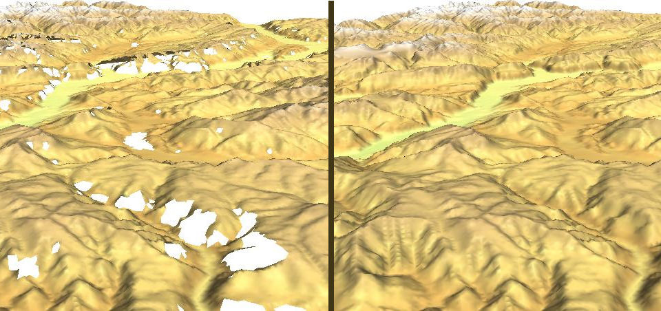
- 2.b: Commonly evaluated list of identified Open Data Sources for Geo-harmonizer.
- 2.c: A complete comprehensive geodatabase with all layers imported and documented.
- 3.a: OpenStreetMap+.
- 3.b: Seamless continental Europe land cover time series at 30 m resolution.
- 3.c: Seamless environmental quality maps, climate change indicators, and potential natural vegetation maps.
- 4.a: Geo-harmonizer Geodata-portal with Integrated Metadata catalogue with thorough documentation.
- 4.b: GeoServer-Extension that allows to publish actinia processed geodata directly as OGC compliant service.
- 4.c: OGC compliant and high performant OGC-services as well as its metadata.
- 5.a: Standardized 3D services, integrated into the metadata catalogue.
- 5.b: 3D web visualization integrated into the Geo-harmoniser geo-portal.
- 5.c: Prototype Virtual Reality application & Prototype Augmented Reality application.
- 6.a: Business model/sustainability plan for post-2021 period.
- 6.b: Identified use cases & potential beneficiary areas.
- 6.c: Best practices guidelines for each selected functional prototype.
- 7.a: Dissemination and engagement pathways established, utilised and impact monitored for feedback into sustainability planning.
- 7.b: A maximum of 3 summer schools/training sessions within the EU.
- 7.c: A minimum of 3 co-development sessions with one from each of the following priority directions: climate, protection of the environment, sustainable use of resources.
1.a: Generic software package (working name “eumap”) as library or package in Python, GRASS GIS, QGIS, R and similar.
| Detailed specifications: | A generic R/Python package which wraps together functions for automated mapping, harmonization and generation of predictions using EO raster layers. Package functions include:
|
| Output type: | Software package |
| Delivery date: | 30.9.2021 |
| Output leader/partners: | MultiOne / CTU, mundialis |
| Delivery format: | https://gitlab.com/geoharmonizer_inea/eumap/ |
| Notes: | The package will be largely based on the “landmap” package and the other similar “data” packages in R (e.g. “bcdata”). The functions could also be released as library or package in Python, GRASS GIS (Neteler et al., 2013; Gebbert et al., 2019), QGIS and similar. |
1.b: Complete documentation and tutorials for basic users and advanced developers.
| Detailed specifications: | The user manuals / tutorials will be developed that will focus on:
|
| Output type: | Web content |
| Delivery date: | 30.9.2021 |
| Output leader/partners: | OpenGeoHub / CTU |
| Delivery format: | Online tutorials (wiki’s) including code tutorials on the project website (geoharmonizer.opendatascience.eu) and on the GitLab homepage. |
| Notes: | The initial version of tutorials should at least show how to load and use the input layers. Once all the final added maps are produced they can be also added. |
2.a: Fully functional metadata-catalogue.
| Detailed specifications: | The metadata catalogue covers the following tasks:
|
| Output type: | Website |
| Delivery date: | 1.6.2020 |
| Output leader/partners: | mundialis / CTU |
| Delivery format: | Access via: https://data.opendatascience.eu/geonetwork |
| Notes: | It is likely that the structure of the metadata-profile will change during the project. |
2.b: Commonly evaluated list of identified Open Data Sources for Geo-harmonizer.
| Detailed specifications: | The overall objective of this task is to search, review and assess existing land cover products, environmental quality maps, climate change indicators, and potential natural vegetation maps as related to the Geo-harmonizer project. |
| Output type: | Report / web-content for the website |
| Delivery date: | 31.10.2020 |
| Output leader/partners: | CTU / mundialis, OpenGeoHub |
| Delivery format: | Report and a web-page |
| Notes: | The assessment shall focus also on uncertainty indicators (see e.g. Merchant et al., 2017). |
2.c: A complete comprehensive geodatabase with all layers imported and documented.
| Detailed specifications: | All input layers required to produce value added maps (M5-M9) will be prepared and served to all project partners via cloud-optimised geo-TIFF images (served via geoserver), point and line data will be served via postgreSQL (PostGIS). The geo-database should include the following folders:
|
| Output type: | Database |
| Delivery date: | 31.12.2020 |
| Output leader/partners: | OpenGeoHub / mundialis |
| Delivery format: |
|
| Notes: | Cloud-Optimized GeoTIFF is ideal for serving data through REST API (spatial queries) but also for visualization of data (Lehto et al., 2019). This deliverable will be mainly inspired by the USGS TNM and OpenLandMap.org viewer. |
3.a: OpenStreetMap+.
| Detailed specifications: | “OpenStreetMap+” is imagine as an improved spatially consistent and complete version of the OpenStreetMap with especial emphasis on:
|
| Output type: | Dataset |
| Delivery date: | 1.3.2021 |
| Output leader/partners: | OpenGeoHub / mundialis |
| Delivery format: | Land use classes will be delivered as GeoTIFFs at resolution 30 m. Vector layers such as lines and points will be delivered as PostGIS layers and served openly through OGC standards. |
| Notes: |
3.b: Seamless continental Europe land cover time series at 30 m resolution.
| Detailed specifications: | All EU land cover products (including all versions of CORINE land cover; European Space Agency, CCI Data Standards, 2018) combined with Sentinel, and Landsat EO products to produce a seamless and harmonized land cover map of continental Europe. The product should include (all at 30 m spatial resolution):
|
| Output type: | Dataset |
| Delivery date: | 1.3.2021 |
| Output leader/partners: | CTU / OpenGeoHub, Terrasigna |
| Delivery format: | Land cover classes, class probabilities and model errors, will be delivered as GeoTIFFs at resolution 30 m. |
| Notes: |
3.c: Seamless environmental quality maps, climate change indicators, and potential natural vegetation maps.
| Detailed specifications: | The Seamless continental Europe environmental quality maps should include:
The climate change indicators should include:
Detailed map of potential natural vegetation. This should include:
|
| Output type: | Datasets |
| Delivery date: | 1.9.2021 |
| Output leader/partners: | OpenGeoHub / mundialis, Terrasigna |
| Delivery format: | All datasets will be delivered as GeoTIFFs and grids to match all other products. |
| Notes: |
4.a: Geo-harmonizer Geodata-portal with Integrated Metadata catalogue with thorough documentation.
| Detailed specifications: | The newly produced Geo-harmonizer data sets will be distributed via a web-mapping data portal. This should allow for:
|
| Output type: | Website |
| Delivery date: | 1.6.2021 |
| Output leader/partners: | OpenGeoHub / mundialis |
| Delivery format: | Specialized server for serving the data and based on Open Source software (CouchDB, AngularJS and OpenLayers, Geoserver, GDAL, R and OGC web mapping services).REST API service will also be installed that allows developers to harvest data more efficiently.
Standardized interface and user-interface, that allow to search, browse and identify geodata sets based on their metadata. |
| Notes: | The data portal would build upon, as much as possible, on the OpenLandMap system (https://openlandmap.org) and the USGS TNM. |
4.b: GeoServer-Extension that allows to publish actinia processed geodata directly as OGC compliant service.
| Detailed specifications: | GeoServer extension implementing actinia/GRASS GIS as a data store. This extension should allow to automatically publish newly processed geodata, that is created through the mechanisms developed in this project, as OGC compliant WM-service. |
| Output type: | Software component |
| Delivery date: | 1.6.2021 |
| Output leader/partners: | mundialis / CTU |
| Delivery format: | Standardized OGC WMS interface |
| Notes: | Depending on the format and content of the data and also on the business model, it may be that the extension also creates WFS and/or WCS services (Růžička, 2016). |
4.c: OGC compliant and high performant OGC-services as well as its metadata.
| Detailed specifications: | Operational OGC OWS services for available geospatial data layers imported into database. |
| Output type: | Software component |
| Delivery date: | 31.12.2021 |
| Output leader/partners: | CTU / mundialis |
| Delivery format: | Software |
| Notes: |
5.a: Standardized 3D services, integrated into the metadata catalogue.
| Detailed specifications: | The output is 3D GIS visualizations based on the available map products developed in A3. This should allow users to interact with data and detect / understand spatial and spatiotemporal connections otherwise not visible in 2D. |
| Output type: | Website / Software component |
| Delivery date: | 1.10.2021 |
| Output leader/partners: | Terrasigna / CTU |
| Delivery format: | Software |
| Notes: | Focus will be put on affordable devices i.e. that can be obtained for few hundred dollars and then can potentially attract a younger audience (an intelligent addition/replacement to their gaming culture). |
5.b: 3D web visualization integrated into the Geo-harmoniser geo-portal.
| Detailed specifications: | Implementation of a 3D GIS prototype into the Geo-harmonizer data portal that will allow an interactive 3D exploration by the user for the newly created map products and testing. |
| Output type: | Website / Software component |
| Delivery date: | 31.10.2021 |
| Output leader/partners: | Terrasigna / mundialis |
| Delivery format: | website |
| Notes: |
5.c: Prototype Virtual Reality application & Prototype Augmented Reality application.
| Detailed specifications: | Set of software/hardware/applications/plugins for development compact applications for VR and AR. |
| Output type: | Workshop / Report |
| Delivery date: | 31.12.2021 |
| Output leader/partners: | CTU / Terrasigna |
| Delivery format: | Software |
| Notes: |
6.a: Business model/sustainability plan for post-2021 period.
| Detailed specifications: | Outline of a business plan that would allow the maintenance and further development of the Geo-harmonizer product, post 2022 including:
|
| Output type: | Report |
| Delivery date: | 30.5.2022 |
| Output leader/partners: | Terrasigna / mundialis |
| Delivery format: | Executive summary of the business model documentations (e.g. European market assessment) available on website |
| Notes: |
6.b: Identified use cases & potential beneficiary areas.
| Detailed specifications: | Use case developments based on user profiling. |
| Output type: | Tabular form, Report annex |
| Delivery date: | 31.3.2022 |
| Output leader/partners: | CTU / mundialis, Terrasigna |
| Delivery format: | Report |
| Notes: |
6.c: Best practices guidelines for each selected functional prototype.
| Detailed specifications: | For each Geo-harmonizer map product a series of potential users have been identified and approach — a guideline report will summarise the interactions and their developments. |
| Output type: | Guidelines |
| Delivery date: | 31.3.2022 |
| Output leader/partners: | Terrasigna / mundialis |
| Delivery format: | Executive summary on the documentation for each followed-up use case. |
| Notes: |
7.a: Dissemination and engagement pathways established, utilised and impact monitored for feedback into sustainability planning.
| Detailed specifications: | A user engagement strategy coupled with a dissemination one will be defined based on the specificity of the Geo-harmonizer products. |
| Output type: | Report / Annex |
| Delivery date: | 1.11.2020 |
| Output leader/partners: | Terrasigna / OpenGeoHub |
| Delivery format: | Blog entry/website |
| Notes: | For this project it is important that the data is used hence we will carefully follow the web-traffic of all public data repositories and browser, and then provide public feedback. Feedback will be used to improve functionality and usability of the components. |
7.b: A maximum of 3 summer schools/training sessions within the EU.
| Detailed specifications: | The user manuals / tutorials will be developed that will focus on:
|
| Output type: | Training / Workshops |
| Delivery date: | 30.6.2022 |
| Output leader/partners: | OpenGeoHub / CTU, Terrasigna |
| Delivery format: | Workshops organized jointly by the beneficiaries.
On-line tutorials (wiki’s) including code tutorials on the project website (opendatascience.eu) and on the GitLab homepage. |
| Notes: | Tutorials should also include video tutorials including recorded lectures (including via the OpenGeoHub Summer School and similar). |
7.c: A minimum of 3 co-development sessions with one from each of the following priority directions: climate, protection of the environment, sustainable use of resources.
| Detailed specifications: | Workshops (3–5 days) for developers (coding sessions) and 2 online tutorials for non-professionals (could be as video materials on youtube). |
| Output type: | Training / Workshop |
| Delivery date: | 31.12.2021 |
| Output leader/partners: | mundialis / Terrasigna |
| Delivery format: | Workshop material and workshops held. |
| Notes: |
